We’ve been on the road a scant 7 weeks, but it seems considerably longer. Our routine is comfortable and itineraries amenable, and we’d most likely make it to 8 were it not for our recent companion—constant rain, some hail, and the threat of snow. Departing southern Colorado with a quiet truck (one broken catalytic converter gets your attention fast), we proceeded on a route home that included one of our favorites: Natural Bridges National Monument in southern Utah.
Our former visit was spent disperse camping up a road near the monument with all the amenities of the real thing but without the crowds. This time, rain was pelting us and, as on our previous visit, all campsites (around 15) were full. We trust our vehicle, and figured an overnight in the bush would be a lark although with some trepidation after spotting the warning that red clay road surfaces can be treacherous when wet. We drove a quarter-mile into a canyon we were familiar with and, on a gentle slope, our truck began sliding. Damn! Saved by a cautious speed, we found a place to turn around and bee-lined it back to the highway. The ranger at the visitor’s center had earlier mentioned a spot on Hwy. 95 (milepost 87) where there was ample space to camp and we did exactly that. The weather broke and we enjoyed a lovely sunset reflecting off the red mesas and the aroma of freshly cleaned sage filling the air with its desert magic while Blue-gray Gnatcatchers whispered and buzzed around us.
With Natural Bridges drenched and more rain coming, we headed on Hwy. 95 to see what awaited us in Capitol Reef National Park. On our former visit in ’08, we’d approached the park following a visit to Canyonlands NP, and arrived via the NE. This trip from the south was new for us, and it was gorgeous—one photo opportunity after another, with a couple hour visit to Hog Springs for a walk in the canyon. We entered Capitol Reef Fruita campground and, consistent with previous good fortune, snagged the last camping spot (camp hosts generally leave handicapped spots available only until it’s apparent they won’t be needed and free them up for late arrivals like us). We popped up our camper truck (this was night #270, by the way, since our inaugural trip in ’06) and dined before walking the mile to the visitor center. I’d glanced at photos of our previous visit, and surprisingly had little recollection of our camping there; photos captured helped somewhat but were mostly images Sooney took of horses grazing in the orchard. What made that trip memorable was the restaurant in Boulder and biking through sections of the Burr Trail. What was it about Capitol Reef that had residents as recently as 1969 raising cattle in Paradise Creek and maintaining over a thousand fruit trees (cherries, apricots, peaches, apples) aided by abundant water in nearby Fremont creek?
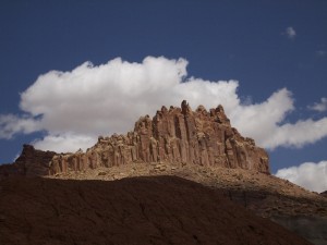
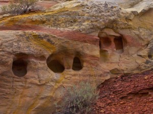 What time didn’t permit us on our former visit were the myriad trails that meander into canyons and onto the white domes and cliffs of Navajo Sandstone, each of which looks somewhat like the United States Capitol building (hence the park’s name). A “reef” is the local word reef referring to the series of layers upon which we hiked up to a grand panorama until ominous clouds and some distant thunder had us scampering back down for protection should the deluge begin. What’s memorable about our hikes were the remarkable hues radiating around use, periodically shadowed and then blazing with color as the clouds passed overhead. The billowing clouds punctuated deep blue skies and moved with unpredictable speed; wait a couple moments and a boring, flat panorama becomes golden with bright sunlight highlighting every angle and curve. So hiking became our activity (of course, where there’s Sooney there’re birds, listed below), and we enjoyed every minute of our visit. On departure day, we drove the “scenic drive” to Paradise Creek and, since it suggested high-clearance vehicles, we were the only folks at the former cattle ranch. Our return on the road had us gawking like kids visiting Disneyland for the first time, with the “Egyptian Temple” mesa particularly stunning with the morning light catching every feature of its name.
Click for more images taken by Sooney.
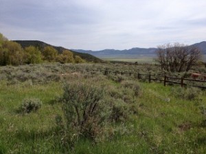
Our eventual destination was another favorite, Great Basin Natural Park, but that would have exceeded our roughly 200 mile driving limit, so we revisited a memorable favorite spot, Maple Grove campground, between Salina (Sa-line-ah) and Scipio, UT. Our memory of birding the forest of maples, oaks, pines, and junipers was compromised by some jerk’s generator that never seemed to run out of fuel. We’ve learned during this trip that an increasing number of larger and larger RV’s are relying more and more on electricity instead of propane. I’m not sure why, but everything from Microwaves, reefers, ovens, air conditioners and water heaters (that hum annoyingly 24/7 regardless of campgrounds “quiet” regulations) have negatively impacted our camping experience on more that one occasion. In Texas, our traveling companion asked the park ranger why they didn’t enforce the “quiet” hours generally before 8 a.m. and after 8 p.m. They shined him on and we speculated that at $20/night (not including the additional daily park admission of $6-8 per person), the state parks want to remain friendly with boomer RV’ers who are hitting the road en-masse. Inconspicuous campers like us with solar panels generating all the power we need are an asterisk in their consciousness.
Aside from the generator, a troop of Apache Boy Scouts and two busses of Head Start children prompted us to move on, and after 268 miles we pulled into Great Basin’s visitor center only to be advised of an ensuing snow storm. En-route from Capitol Reef, I’d driven through a hail shower that left the road glimmering in the back-lit sun (and cleaned most of the bug carcases off our camper’s bow!), but snow wasn’t something in which we wanted to camp—especially at 7,000’ elevation. So we continued to wonderful Ely, NV (that’s E-Lee) and snagged a crappy meal and a warm shower before continuing the journey as early as possible the following morning.
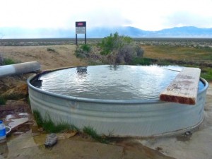
With snow chasing us, and some high passes between us and Spencer Hot Springs on Hwy. 50 (the “loneliest highway in America” for a good reason), we’re moving west and hoping the rains accompany us all the way to southern Oregon. Our companion along this leg of the journey was the audio recording of Laura Hillenbrand’s “Unbroken,” the roller-coaster saga of Olympian, aviator, and survivor, Louie Zamperini. What a wonderful lesson on the power of forgiveness!
Bird sighting’s along this leg of the journey:
Capitol Reef National Park
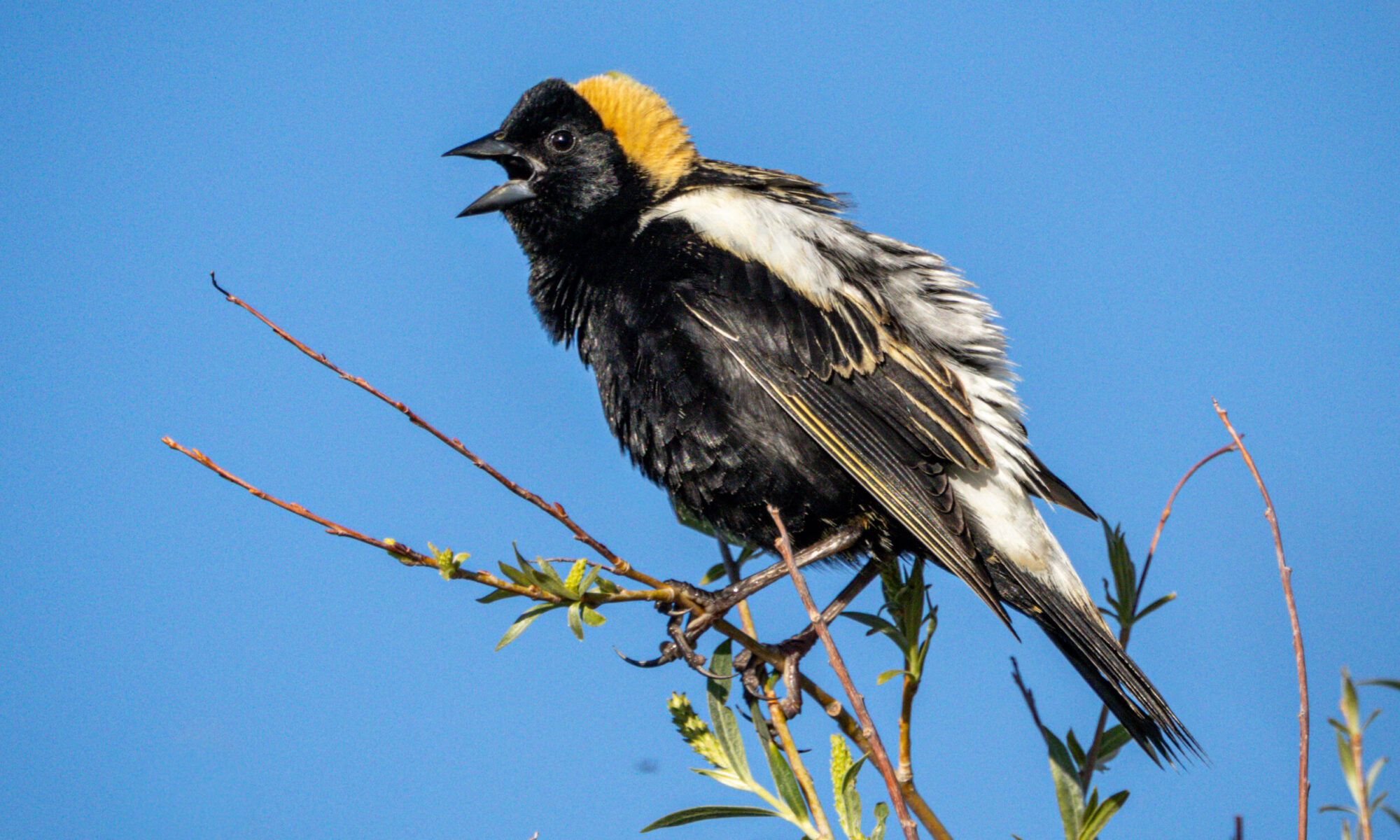
Turkey Vulture, Red-tailed Hawk, Merlin, Prairie Falcon, White-throated Swift, Red-naped Sapsucker, Northern Flicker, Black Phoebe, Say’s Phoebe, Ash-throated Flycatcher, Western Kingbird, Western Scrub Jay, Common Raven, Tree Swallows, Cliff Swallow, Bushtit, Canyon Wren, Blue-gray Gnatcatcher, American Robin, European Starling, Yellow Warbler, Yellow-rumped Warbler, Yellow-breasted Chat, Spotted Towhee, Chipping Sparrow, Song Sparrow, Dark-eyed Junco, Black-headed Grosbeak, Brewer’s Blackbird, Bullock’s Oriole, House Finch
Near Torrey, UT
Chipping Sparrow, Lazuli Bunting, Cassin’s Finch
Maple Grove, UT
Great Blue Heron, Turkey Vulture, American Kestrel, Mourning Dove, Tree Swallow, Black-billed Magpie, Ruby-crowned Kinglet, Mountain Bluebird, American Robin, Yellow Warbler, Green-tailed Towhee, Chipping Sparrow, Lark Sparrow, Song Sparrow, Black-headed Grosbeak, Lazuli Bunting, Brewer’s Blackbird, Western Meadowlark, Cassin’s Finch
Hwy 50 East of Eureka, NV
Juvenile Golden Eagle, a flock of Horned Larks
Spencer Hot Springs, near Hickison Petroglyphs, off Hwy 50 NV
Gray Flycatcher, White-crowned Sparrow